
I recently picked up a series of leaflets that describe the route of the Taff Trail from Cardiff to Brecon. They were produced by the Taff Trail with support from Mid Glamorgan County Council, Taff Ely Borough Council and the Welsh Office. This information helps me date the leaflet to between 1988, when the trail was launched and 1996, when Mid Glamorgan County Council was disbanded.

takeaway route for pedestrians and cyclists
“Above Castell Coch, the Trail’s only steep section climbs through a magnificent beech woodland and offers dramatic views of the Taff Valley. Beyond the Forestry Commission plantations, the path follows a former railway line. Castell Coch was designed in the 1870’s by the architect William Burgess, for his patron the third Marquess of Bute. Known locally as “the Fairytale Castle”, it occupies the site of a genuine medieval stronghold.”
The Taff Trail leaflet
Welcome to the Taff Trail
“The Taff Trail links Cardiff and Brecon with an attractive countryside path designed for walkers and cyclists. This leaflet is the second in a series of four, and describes the route from Castell Coch to Pontypridd.
“This section follows old railway lines with easy gradients and smooth surfaces. The only exception is the path through Fforest Fawr: here there is a steep 300 metre climb from Castell Coch, followed by a steady descent to the converted railway line at Ty Rhiw. The extra effort is rewarded by the fine views of the Taff Gorge and the beautiful woodland – enjoy the viewing platform halfway up. Cyclists should dismount in the grounds of Castell Coch.
Before the Taff Trail
Three Castles Cycle Route
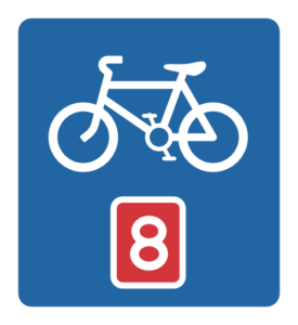
Before the trail, there were several similar but disconnected routes in the area. Taff Ely borough council had created cycling routes within its boundaries, Cardiff city council had provided the Three Castles Cycle Route from Caerphilly into Cardiff.
The Three Castles Cycle Route was one of the first sections of Lôn Las Cymru, which is also known as National Cycle Route 8.
Lôn Las Cymru runs for over 370 miles down the whole length of Wales from Holyhead to Chepstow or Cardiff.

The Launch
From Cardiff to Brecon
The Taff Trail was launched in September 1988 by Sir Wyn Roberts, Minister of State for the Welsh Office.
It runs for 55 miles between Cardiff and Brecon.
The original logo, which I’ve recreated, is featured on the leaflet and the 1993 guidebook by Jeff Vinter. The Cefn Coed viaduct is on the front cover so I’m assuming this is the inspiration for the branding.
I’ve seen the logo used in a few other places but it doesn’t appear to be in use any longer.

“Please keep the left. Remember that the path is shared – when overtaking, ring your bell or call out a friendly greeting. Along the route you will find occasional barriers these are essential to exclude horses and motorbikes. Dogs are welcome, but please keep them under control and don’t let them litter the path.

“The Trail crosses rights of way, including paths to Eglwysilan, Craig yr Allt and Fforest Fawr. Some of these are waymarked with yellow (= footpath) or blue (= bridleway) arrows, giving lots of scope for circular walks. The Taff Trail itself is waymarked with the viaduct symbol.”
The National Cycle Network

The Taff Trail is now part of the National Cycle Network, which was launched in 1995 by Sustrans. The official route doesn’t take you past the castle today. The trail enters Tongwynlais from the south on Ironbridge Road, takes you through the village on Merthyr Road and then towards Taffs Well beside the A470.
If you turn right by the Lewis Arms, you can climb up to Castell Coch on Mill Road/Castle Road, then through the gate and up the hill.

If you’re planning to visit Castell Coch using the Trail from Cardiff, the route is about 9 miles and well signposted.


Very good article, I was born in Taff’s well in 1950.my family had a 10 acre small holding on the land that is now occupied by the houses opposite the village. We raised pigs,etc from 1910,till the taff destroyed it in 1960,s.